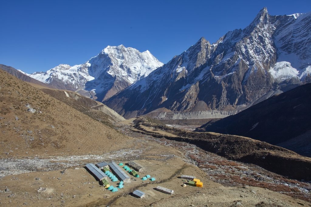
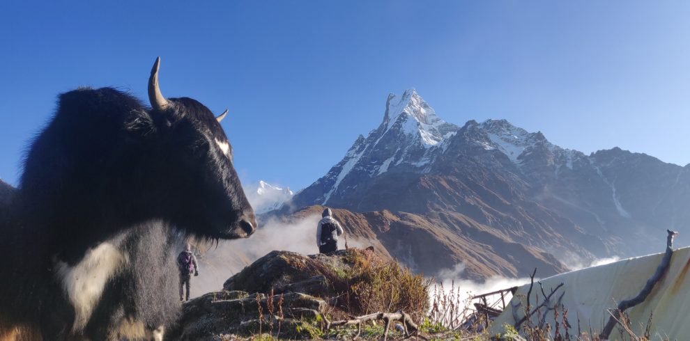
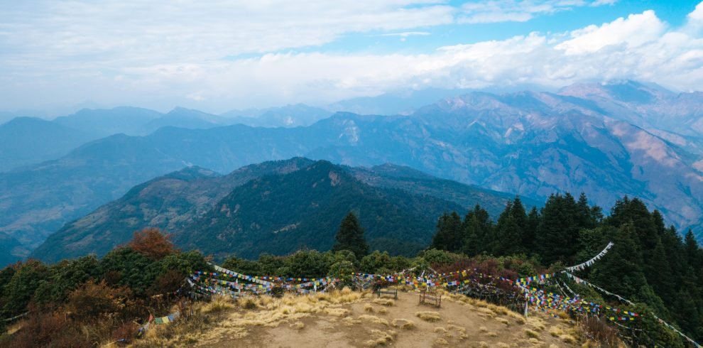
The Manaslu region is a Himalayan haven untouched by urban influence. So close to the Tibetan border, ancient monasteries, Chortens, Mani walls, Gompas, and beautiful landscapes are some of the major highlights of this region. Besides the scenery of Mt.Manaslu, panoramic views of Himlung Himal, Gyangi Kung, Kang Koru, Cheo Himal, and Annapurna II are seen from a touching distance once you reach Larkya La Pass. This trek is for those travelers who want to get away from the popular treks of Nepal. This is not a mainstream trekking route although its popularity is skyrocketing.
The unique cultural diversity shared by the Nepalese and Tibetan people of the reason are heartwarming. Traveling to the base of the 8th highest mountain is a privilege one can only dream of that we make it a reality.
Overview
<p><b>Starting Trek point: Soti Khola</b></p>
<p><b>Ending Trek point: Tal</b></p>
<p><b>Highest altitude to gain: Larkye La Pass (5106 m)</b></p>
<p><b>Difficulty: 4.5 out of 5</b></p>
<p><b>Seasons to avoid trekking here: January-february and Mid-June to August (winter season & monsoon) </b></p>
Itinerary
Altitude information: Kathmandu (1400m)
Your arrival will be awaited by our representatives at the Tribhuwan International Airport (TIA). You will be transferred to the hotel rooms in the city along with your luggage. There is no specific activity designated for this day. You will meet the rest of the trekking team and representatives and you will have all the freedom to prepare yourself for the next day.
Overnight in Kathmandu
Lunch, breakfast and dinner included
Altitude information: Kathmandu (1400m), Arughat Bazaar (519m), Soti Khola (700 m)
We will be heading out from Kathmandu early in the morning in a bus. It will take us about 7 to 8 hours to reach Arughat. Once we reach Arughat we will have to drive for one more hour to reach Soti Khola. The road condition is not very good so you should expect bumps and shakes here and there.
.
Overnight in Soti Khola
Lunch, breakfast and dinner included
Altitude information: Soti Khola (700 m), Machha Khola (900 m)
We have our breakfast and start our trek. The trail is rugged and narrow but safe enough to walk. We walked through the forest of Sal tree. There are few settlements in Ghale and Gurung communities. We start by walking along the Budhi Gandaki. We then reach Nyayi Khola from where we head towards Machha Khola. We would have covered about 14 kilometers by the end of the day.
.
Overnight in Machha khola
Lunch, breakfast and dinner included
Altitude information: Machha Khola (900 m), Jagat (1340 m)
Today we will be entering the restricted area. We start by following the Budhi Khola and through the forest trail. We then come across Tatopani where we can take a short relaxation break before crossing the Dovan Khola through a suspension bridge. Finally, we pass through a cantilever bridge to reach the village of Jagat where your permits will be checked.
Overnight in Jagat
Lunch, breakfast and dinner included
Altitude information: Jagat (1340 m), Deng (2095 m)
Today our goal will be to reach Deng village. We have got a steep trail ahead of us. We will head to Sirdabas which is popular for the view it grants of Shringi Himal. This small village reflects the Buddhist and Tibetan culture as the village is decorated with small Gompas. We then pass through another suspension bridge to take a short break at Philim. There are huge waterfalls throughout the trail and today while walking through the rhododendron forest we will come across some of it.
Finally, after crossing the Siyar Khola bridge we will arrive at Pewa where there are only two tea houses but with every basic facility required. We will then walk further through a bamboo forest to stay overnight in Deng.
Overnight in Deng
Lunch, breakfast and dinner included
Altitude information: Deng (2095 m), Namrung (2607 m)
Today we will pass through one of the landslide-prone areas of this region. We will walk through small settlements influenced by the Tibetan culture. There are Mani walls and Chortens throughout the way leading to Namrung village. This village has some tea shops with Wi-Fi and fancy beverages. The trail will be rugged and steep so we will relax today in the village of Nmarung and prepare for tomorrow.
Overnight in Namrung
Lunch, breakfast and dinner included
Altitude information: Namrung (2607 m), Lho (2957 m)
As we get higher, the view of Manaslu gets more prominent and today we will walk through the Tibetan-based surrounding trail throughout the day. We will have a grand view of peak 29, Manaslu North, and the main peak of Manaslu. This beautiful mountain with a distinct pointy look is the eighth highest mountain in the world standing at 8163 meters. We will spend our night here in Lho.
.
Overnight in Lo Lho Gaun
Lunch, breakfast and dinner included
Altitude information: Lho (2957 m), Samagaon (3528 m)
We will gain an altitude of 3500 m today. This is where we have to maintain our pace and trek slowly. If you have never gained this kind of altitude then walking slowly and hydrating yourself often is very important. With that said we start trekking. We first trek towards Shyapla. We will have a mountain view ahead of us the entire day. Once we reach Shyapla it takes only about an hour for us to reach Samagaon. We will rest tonight here and enjoy the Gompas and Tibet influenced the lifestyle of the Nepali people.
Overnight in Lo Samagaon
Lunch, breakfast and dinner included
Altitude information: Samagaon (3528 m)
Today our main goal would be to acclimatize our body to the altitude. As we gain more and more altitude we need to make sure we sleep at a lower altitude than what we have achieved that day. So, we have an option for a half-day hike or a full-day hike. If you are tired and feel like you need some rest, a short hike to Birendra Taal would suffice but if you are feeling extra adventurous then taking a hike to Manaslu Base camp would be the best way to acclimatize. It will take us about 5 hours to trek to the Makalu base camp (4800 m).
Overnight in Samagaon
Lunch, breakfast and dinner included
Altitude information: Samagaon (3528 m), Samdo (3800 m)
From this point onwards the barren land of the Manaslu region becomes prevalent. The yak grazing, main walls, and the simple rural life of people living here in Samdo are quite extraordinary and fascinating to observe. Since we are now above 3500 meters we will have to cover distance very carefully so we will walk about 3 to 4 hours to reach Samdo where we will rest and hydrate ourselves after exploring the village of Samdo.
Overnight in Samdo
Lunch, breakfast and dinner included
Altitude information: Samdo (3800 m), Dharmashala (4496 m)
If you feel like the body needs some more time to acclimatize we can spend one more day in Samdo and hike towards the Tibetan border or else we march forward. We will first pass the Larkye Bazaar with a beautiful view of the Manaslu range. Then we head towards Dharmashala which will take us about 4 to 5 hours where we will have covered roughly 6.5 kilometers of distance. We will as usual hydrate ourselves, drink plenty of garlic soup, and enjoy the starry night in Dharmashala.
Overnight in Dharmashala
Lunch, breakfast and dinner included
Altitude information: Dharmashala (4496 m), Larkya La Pass (5106 m), Bhimtang (3708 m)
This is it! Today we will be getting to the highest point of this trek. In the daytime, it can get very windy at a higher altitude so we start hiking in the early morning. We will walk very slowly to avoid any kind of altitude-related problems. It might take us around 6-7 hours to reach the Larkya pass depending on the walking pace.
The view from the top of the Larkya pass is insane, to say the least. It feels like you are on a different planet. You will be right below some of the highest peaks in the world. Exceptional views of Himlung Himal, Gyangi Kung, Kang Koru, Cheo Himal, and Annapurna II are seen from a touching distance once you reach Larkya La Pass. After spending some quality time and taking millions of pictures we descend to Bhimtang and drop significantly in altitude.
Overnight in Bhimtang
Lunch, breakfast and dinner included
Altitude information: Bhimtang (3708 m), Tal (1700 m)
The hard part of the trek is over. From this point, it is all about descending. The trail gets less windy as we head downwards. The settlements we spend the nights in are warmer and the altitude sickness worries become minimal. We pass through Karcher La pass and as we move to lower altitude we start seeing rhododendron forest and small bushes. We reach Tilije from where we will further walk to Tal to spend our night.
Overnight in Tal
Lunch, breakfast and dinner included
Altitude information: Tal (1700 m), Kathmandu (1400m)
From Tal we can either book a jeep or get on a local bus to Kathmandu. Jeeps are comfortable and somewhat more expensive than bus.
FAQs
This is a difficult trek that can be completed with proper guidance and gear. Some days might be tough where you have to gain massive altitude in a single day but to make the trek easier extra days can be added to the schedule and longer walking days can be divided to protect yourself from altitude sickness and fatigue. Since there are tea houses at all the checkpoints and no need for camping, it is not the most difficult trek that Nepal has to offer.
Accommodation in this trek is completely tea house oriented. This is not a luxury trek so you will have to make some compromises. There are not a lot of tea houses in some checkpoints so we will spend nights in villages where we will be pampered by the locals of the Himalayas. The tea houses are only equipped with basic needs such as running water, food, beds, and latrines. Hot showers are also available but it is good to avoid showering at very high altitudes.
You will have to be physically and mentally prepared for this trek. Preparing physically through cardio workouts, lower body workouts, and core strengthening exercises are highly recommended. Remember you will be crossing around 5100 meters of altitude. If you are a novice trekker, regular physical preparation is very important. This trek is most difficult because it is a recently opened trekking route with very few tea houses and facilities.
Yes! When you gain altitude oxygen level decreases in the surroundings, but with a healthy diet, hydration, and slow-maintained walking pace it will not be a problem. If you see any signs of altitude sickness our guides and porter will guide you to a lower altitude for recovery.


